-
Roadside noise cameras await approval to start issuing fines for loud vehicles in France
The devices known as meduses already exist in several cities but so far have only been ‘instructional’
-
White storks make strong return in France via nest ‘platforms’ and clipped wings
The Ligue pour la Protection des Oiseaux shares the conservation challenges in saving these birds from extinction
-
Hosting scheme in south-west France lets newcomers sample lifestyle
Households in nine Dordogne communes volunteer under Mes Nouveaux Voisins scheme
MAP: See how hot areas of France are set to get today and tomorrow
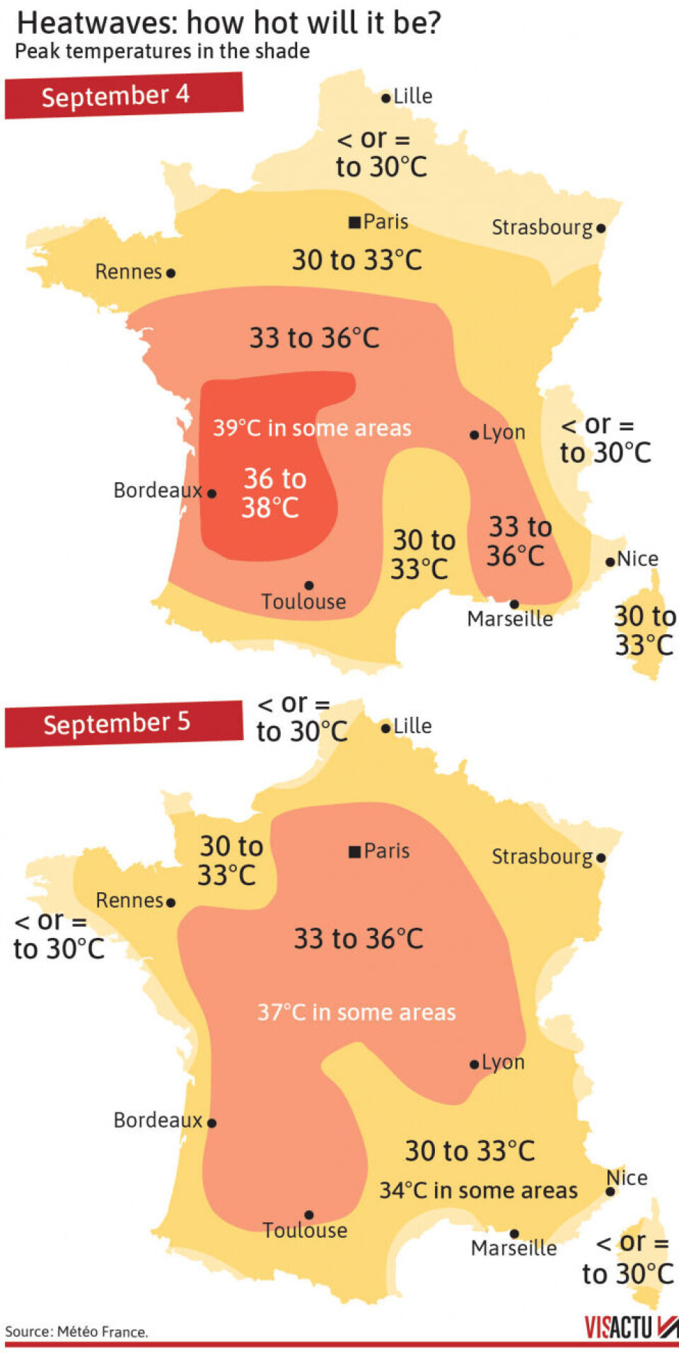
See where temperatures could reach up to 39C, and where they could be highest on Tuesday

With France facing another heatwave, temperatures across the country are expected to be significantly warmer than September averages.
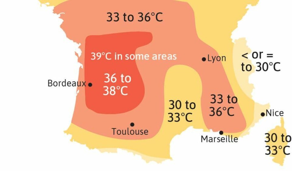
Although expected to last the duration of the week, the heatwave will be warmest at the beginning of the week, with temperatures of up to 39C in parts of the south west.
On Tuesday, although such extreme highs are not expected, the warm weather will spread across most of the country, with almost the entirety of France facing temperatures of around 30C or higher.
You can see a map of forecast temperatures below:

Credit: VisActu / The Connexion
The warm temperatures on Monday are being helped in part by cloudless skies and sea winds in the Nouvelle-Aquitaine region pushing the hot air inland.
Except for minute spots in the county, such as the tip of Brittany, and mountains on the Swiss border, all of France is expected to be at least 36C, with some areas reaching 37C.
Temperatures are expected to be slightly lower for the rest of the week, but not fall significantly until at least Sunday, according to Météo France.
Related articles:
Return of hot weather this week in France: for how long and how hot?
France heatwave: what to (and not to) eat and drink


