






-
Murder inquiry launched after Briton, 85, found dead at his home in Gers in south-west France
The man was attacked during the night of Friday to Saturday. His car is reported stolen
-
Why hornets can be more dangerous in France in autumn
Cyclists, runners and walkers attacked around country
-
New TGVs delayed as France opens railways to competition
Concerns grow over the future of smaller stations
Aude placed under orange weather alert for high winds
Wind speeds could reach 130km/h tonight in some areas of the department as a result of the tramontane
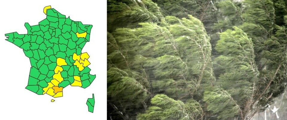
The department of Aude is on an orange weather warning for high winds today (February 1) as the tramontane wind rears its head.
The alert will only last from 19:00 until around 03:00 tomorrow morning, but the wind could cause considerable disruption.
What is the tramontane?
Tramontane is the classical name for a northern wind, and is used in several European countries.
In France, it is a strong, dry, cold wind coming from the north towards the Mediterranean, similar to the mistral.
However, while the mistral comes down the Rhone Valley, this wind accelerates as it passes by the Pyrenees and the Massif Central.
How strong will it be?
Gusts of 90-100km/h are already being recorded over the Corbières mountains, and wind speeds are expected to reach 120km/h in the east of the department as the night draws in.
Between the Corbières and Narbonne, as well as around Leucate, winds could get up to 130km/h.
The tramontane will abate slightly during the second half of the night, but gusts of 80-90km/h are still expected tomorrow.
Do I need to do anything?
Residents are advised to secure any items which could be exposed to the wind and to stay inside if possible. If you do go out, be aware of the potential for branches and other objects to fall as a result of the weather conditions.
You can find out more about the weather conditions on the national weather service Météo France.
Related stories
Storm Corrie and mistral: High wind alerts for north France and Var


