-
Return of cold in France brings frost and heavy snow, vineyards at risk
Experts warn that cold snap could cause ‘irreversible’ damage to crops
-
French mountain holidays are no longer just for skiing
Resorts back expansion of offerings amid ski uncertainty
-
France tightens checks on small non-EU parcels, UK magazine deliveries impacted
Attempts made to avoid French tax by delivering via other EU countries
Floods, storms, rain: most of France on weather alerts
Warnings set to heighten overnight in south-east with red alert coming into force

A series of storms are on course to batter much of France for the remainder of the week, with over half of all departments facing a weather warning of some kind over the next two days.
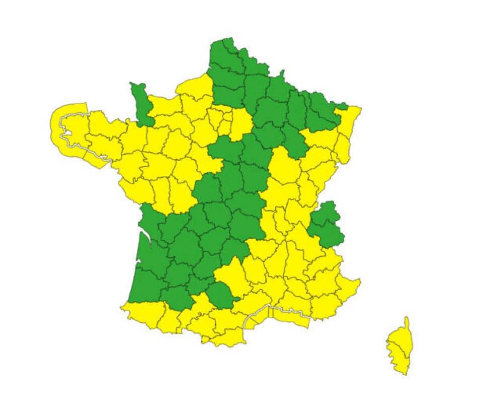
More than 50 departments are on tier-two yellow alert for stormy weather today (October 19), both in the north-west and east of France.
There are eight departments (Ardèche, Haute-Loire, Rhône, Loire, Isère, Drôme, Alpes-Maritimes, and Alpes-de-Haute-Provence) facing tier-three warnings orange this evening.
Numerous other departments are facing tier-two warnings for strong winds, heavy rains and flash flooding, coastal flooding, or river flooding.
As of this morning all warnings for the day are at tier-two yellow level.
However, in six south-eastern departments, these warnings will increase to tier-three from Friday morning, as storms in the area pick up in intensity overnight.
Read more: What to do (and not do) during heavy rain and flood alerts in France
Warnings across most regions
A combination of different weather phenomena is causing the raft of warnings.
In the south and south-east, the éposode cévenol is still in full force, however it will begin to calm down in the Ardèche, Drôme, Hérault and Gard departments from this evening.
You can see videos of rivers breaking their banks below:
SEE: dramatic scenes of rising river water after heavy rain in France
Rainfall is still expected in these departments until Friday evening, although it will be less intense than at the beginning of the storm on Tuesday.
The south-east and Corsica, however, will contend with more rainfall from Thursday night, causing the increase in warning levels in place for Friday.
You can see the departments currently predicted to face increased alerts tomorrow in the post on X (formerly Twitter) by Météo France below.
🔴#Vigilancerouge
— Météo-France (@meteofrance) October 19, 2023
🌧️#pluieinondation
🗓️ Vendredi 20 octobre
Épisode de fortes pluies sur les Alpes du Sud, particulièrement marqué sur les #AlpesMaritimes. Une attention particulière doit être apportée dans les vallées et les zones urbanisées.
👉https://t.co/w5OGXbEEhP pic.twitter.com/LNkaZQaQDX
Although the number of orange-level warnings in place is set to fall, in the Alpes-Maritimes a tier-four red alert is in place for heavy rain and flooding, will come into force pvernight and last until Friday afternoon.
Overnight rainfall around Nice could be well over 50mm, with the storms set to last well into Friday daytime.
Météo France is advising those who live in urban areas and valleys in the department to be extra vigilant of the storms tonight.
A screenshot of the rainfall predicted at the height of the storm (05:00 Friday morning) is shown below.
In the north of France, a storm moving in from the English Channel will hit Brittany and Normandy, with departments in the area on alert for stormy conditions as well as high winds and coastal flooding.
Warnings relating to this storm go as far inland as Paris, and it will be at its most intense in the capital during the evening.
In the south-west, warnings for strong winds are in place in departments on the Spanish border – winds of over 110 km/h are expected in the Pyrénées mountains today.
The east of France is also facing storms today, although these are expected to be less severe than their southern and north-western counterparts.
A map of all the departments currently facing warnings this Thursday can be seen below.
You can keep up to date with weather warnings though the Météo France website here.

Credit: Météo France
Weekend weather outlook
Unlike the storms in the south-east, by Friday the severity of the eastern and north-western storms will subside.
However, a number of departments will still have warnings in place for high wind, heavy rain and flash floods, particularly in the south-west.
It is expected these warnings will be updated before tomorrow as weather patterns become clearer.
Rainfall will persist in some areas, particularly the north-west and south-east on Saturday.
Skies on Sunday are set to be clear, however, with barely a drop of rain predicted to fall – temperatures will be much closer to autumn averages and a far cry from the record-breaking heat at the beginning of the month.
Related articles
Vehicles, homes: claiming compensation for weather damage in France
Storms in France: what to do if at home, out walking or in car


