
-
New easyJet aircraft to be equipped with ultra lightweight seats, additional legroom
UK carrier will install modern seats on more than 200 new aircraft
-
Firefighters in France deliberately start fires to prepare for summer risk
The exercise is part of efforts to prevent real, uncontrolled blazes
-
South-west France motorway to adopt barrier-free tolls
The A69 linking Castres and Toulouse will be the first motorway in Occitanie to adopt the flux libre system
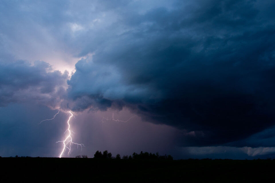
Northern France on storm alert, risk of violent winds
12 departments in Ile-de-France and the surrounding areas are under an orange warning. Up to 40mms of rain expected in some areas
[Update September 5 at 16:15 - Hérault and Gard were also placed under an orange weather alert in Météo France's 16:00 update.]
Some 12 departments in northern France have been placed under an orange storm alert this afternoon (September 5).
The departments are: Cher, Loiret, Oise, Aisne and all those in Ile-de-France.
National forecaster Météo France has warned that the storm will begin in Centre-Val de Loire and then climb towards Ile-de-France and Hauts-de-France.
It will bring wind gusts of up to 110km/h, 10-20mm of rain – and up to 40mm in some places – hail and lightning.
🔶 12 dpts en #vigilanceOrange
— VigiMétéoFrance (@VigiMeteoFrance) September 5, 2022
Restez informés sur https://t.co/rJ24zzmmy4 pic.twitter.com/QahE5VCEE9
The orange warning should come to an end at around 22:00 this evening.
Advertisement
A further 62 departments are under a yellow storm alert.
You can find out more on the Météo France website.
Related articles
What’s coming up? The week ahead in France
French drought causes early – and poor – apple harvest in Brittany


