-
AI photos make long-running ‘parcel for you’ scams more credible In France
Fraudsters send texts with fake parcel photos displaying your name and address
-
Niche tours create new opportunities for guides in France
Guided tourism is no longer the preserve of travel agencies, tourist offices or museums
-
‘Accidental’ Americans in France welcome lower fee to give up citizenship
Many people face administrative issues linked with being American
Red alert for rain and floods in south-west France: stay home if can
People in five departments are encouraged not to travel. Areas of northern France are on orange alert

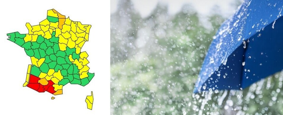
Five departments in south-west France have been placed under a red weather alert for heavy rain and flooding.Residents are being encouraged to stay home if they can.
Landes and Pyrénées-Atlantiques are on a warning for high river levels, while Hautes-Pyrénées, Haute-Garonne, Ariège and Pyrénées-Atlantiques are under alerts for heavy rain and flash floods.
🔴 5 dpts en #vigilanceRouge
— VigiMétéoFrance (@VigiMeteoFrance) January 10, 2022
🔶 4 dpts et l'Andorre en #vigilanceOrange
Restez informés sur https://t.co/rJ24zzmmy4 pic.twitter.com/OzgCqu4SYb
Météo France predicts an episode of unusually heavy and sustained downpour.
In the affected departments the rain began over the weekend, with 116mm of precipitation already recorded in Laruns-Hourat (Pyrénées-Atlantiques).
Three departments – Gers, Aisne and Nord – are also under orange weather alerts for high river levels and Pyrénées-Orientales is on an avalanche warning.
Between this morning and around 18:00 this evening, the rain will continue, with five to 10mm expected to fall each hour. Overall, 50-80mm is predicted on lower ground, 100-130mm in the Pyrenean foothills and 150-250mm in the mountains.
This rainfall is forecast to cause waterways to burst their banks and may lead to landslides.
“We are expecting very high river levels across the whole western part of Pyrénées-Atlantiques,” said the department’s subprefect Théophile de Lassus. The flooding is predicted to particularly affect the Gave d’Oloron river, as well as the Nive and the Nivelle.
So far “there have not been any significant reports” of flooding incidents, but Mr de Lassus added that fire and rescue crews were called out to five incidents yesterday.
“More than 100 fire crews and gendarmes remain mobilised and are following the situation.”
In the Aspe, Ossau and Tardets Valleys school transport services have been suspended and parents are encouraged to keep their children at home if possible.
In the early evening the rain will gradually abate, and the red alert will be downgraded to orange.
The weather should return to normal overnight in the east and tomorrow morning (January 11) in the west.
You can follow the situation on the Météo France website and government information service Vigicrues.
Do I need to do anything?
In areas affected by the rainfall people should try to stay at home if possible, avoid driving and make sure to keep away from bodies of water and bridges if they do need to go out.
People are also advised by Météo France not to go and collect their children from school.
Residents should only evacuate their houses if told to do so by the authorities.
In the meantime, it is advisable to move damageable possessions upstairs [if you live near a river or other waterway] and not to go down into the cellar or basement.
“The main safety advice is to limit your movements, to stay at home, to go upstairs if you live near a waterway and to take with you any possessions that could be damaged,” Mr de Lassus said.


